WorkOutDoors |
|
WorkOutDoors |
|
WorkOutDoors is the most powerful and configurable workout app for the Apple Watch. You can create multiple screens from a choice of 800+ metrics, including a vector map. It is the perfect app for any type of outdoor workout: running, hiking, cycling and more.
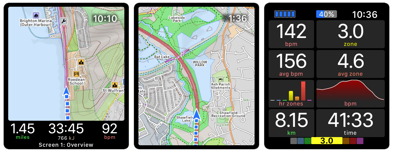
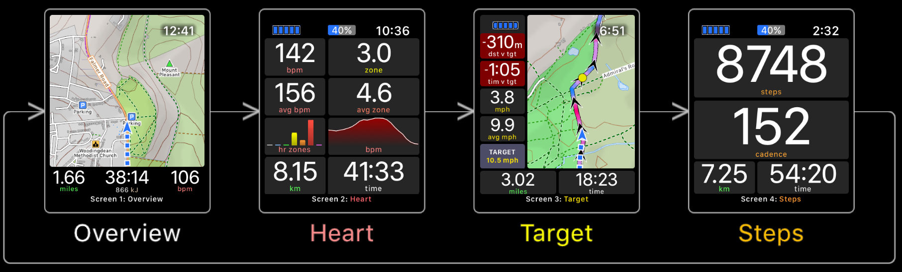
WorkOutDoors allows you to configure multiple data screens and to swipe through them during a workout. You can customise the layout, font size and content for each screen. Adjacent fields can be merged to create larger fields by setting them to the same metric.
The app also includes many other advanced workout features, such as:
- periodic alerts (e.g. every mile, every 1000 steps etc);
- limit alerts for heart rates, pace, speed and cadence;
- configurable displayed and spoken metrics for each alert;
- automatic laps (e.g. every mile or km);
- lap splits available for all metrics;
- manual intervals;
- Interval schedules (Warm Up, Fast, Recover etc)
- connection to a wide variety of Bluetooth sensors;
- configurable heart rate, pace and power zones;
- configurable target pace/speed with related metrics;
- target can be shown as a live icon on the map;
- compare performance against a previous workout;
- 3 configurable rolling pace fields (e.g last mile);
- configurable shortcut gestures for commonly used operations;
- set actions for gestures: e.g. double tap starts an interval;
- ability to display music controls in response to a gesture
- 42 different activity types;
- many types of graphical metrics;
- button fields provide shortcuts for any operation;
- workouts saved to Apple's Health system and to WorkOutDoors;
- advanced workout analysis in the WorkOutDoors iPhone app;
- summary information available on the watch at any time;
- workouts can be exported as FIT, TCX or GPX files;
- automatic direct uploading to Strava, even from the watch;
Click here for more information on workouts.
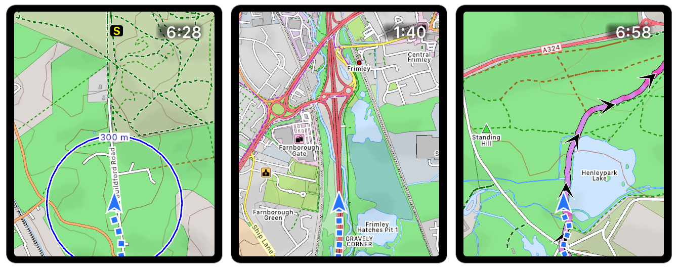
The maps are perfect for outdoor workouts, including paths, trails, tracks & ski pistes. They can be smoothly panned with your finger and zoomed by using the digital crown. They can also be stored offline on your watch for use when there is no data signal. Choose from standard maps or topographic maps with contours and hill shading.
Maps for the whole world are included. There are no subscriptions or extra payments.
The map has many other advanced features, such as:
- Breadcrumb trail of your whole route is displayed on the map;
- Scale is shown when zooming, showing distance to features;
- Map can auto-rotate with direction of travel or the compass;
- GPX / TCX / FIT Routes can be displayed on top of the map to aid navigation;
- Turn by turn navigation if contained in the route file;
- Bend Detection to create turns if no turn by turn in the route file;
- Climb & Descent detection with coloured profiles on screen during a workout;
- Routes are coloured by gradient: from red for uphill to blue for downhill;
- Routes can be shown 'hollow', to see the trail underneath;
- Alerts are generated when you deviate from the GPX route;
- Waypoints can be created, navigated to, and exported;
- Also navigate to points on the map (e.g. hospitals, cafes, sights etc);
- Compass can be displayed (and also toggles auto-rotation);
- Green compass points to start (and shows distance if tapped);
- Map-only is available for when you don't want to start a workout;
- Maps are highly customisable with many different colour schemess;
- Geocaching files with groudspeak waypoints are displayed as icons;
- "Smart Contours" use colours to help read the terrain;
Click here for more information on the maps.
Email us for more information, or check out our Press Kit or our Privacy Policy.